
Landscope America: Open Space at Risk Wall Map by National Geographic
$84.99 – $569.99
Size: 42" x 30"
Publisher: National Geographic
Published: 2023
Printed By: MapShop
Published: 2023
Printed By: MapShop
$84.99 – $569.99
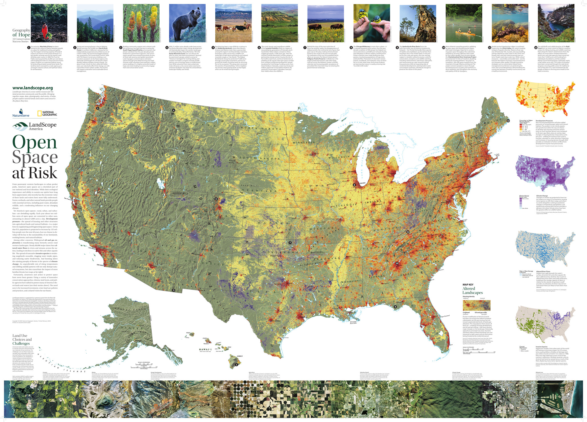
The National Conservation Wall Map tells the story of the changing face of land conservation in the United States and the continuing threats to the nation's open space. Open Space at Risk, highlights pressures facing open space preservation from development pressure to oil and gas development to loss of agricultural lands. Inset maps show projected residential development in 2030, areas most vulnerable to climate change, severely altered river flows, and the spread of invasive species. Stories at the top of the map describe how organizations across the country are working creatively and cooperatively to save places in the face of these growing threats.
| Size | 42" x 30" |
|---|---|
| Publisher | National Geographic |
| Map Type | Wall Map |
| Printed By | MapShop |
| Published | 2023 |

