
Lake Tahoe Basin Wall Map by National Geographic
$84.99 – $329.99
Size: 26.5" x 40.5"
Publisher: National Geographic
Published: 2023
Printed By: MapShop
Published: 2023
Printed By: MapShop
$84.99 – $329.99
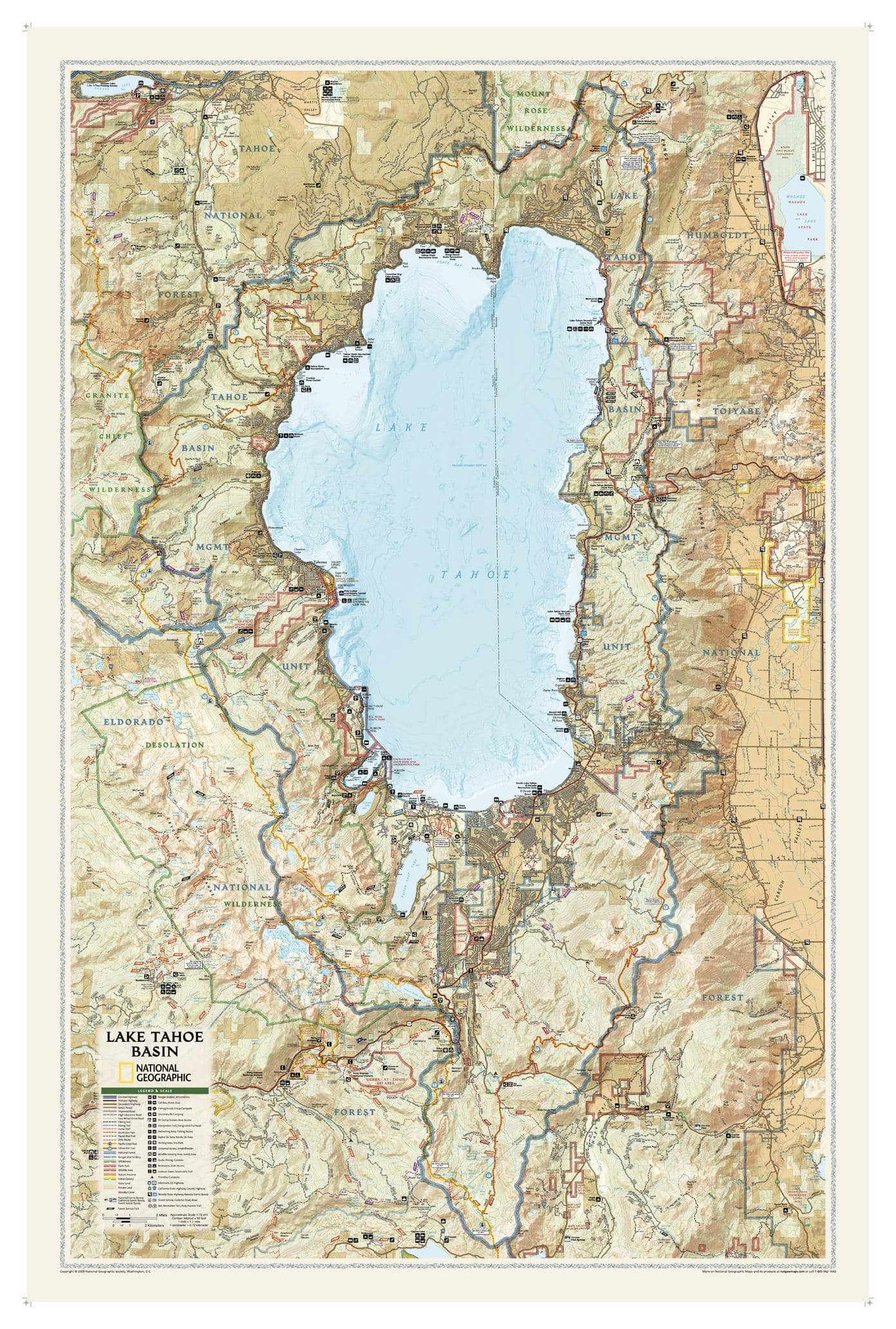
National Geographic’s wall map Lake Tahoe Basin is one of the largest and most detailed maps available of this spectacular area that straddles the California-Nevada border. Beautifully rendered and overflowing with information, it is the perfect addition to any home, office or school decor. Stunning shaded relief along with topographic and bathymetric contour lines produce an unparalleled visualization of the lake and the surrounding private and public lands, including national forests, wildlife and wilderness areas, state parks and nature preserves. Land and water recreation sites are pinpointed, such as trails, including the Pacific Crest, Tahoe Rim and Pony Express trails, scenic byways and areas for swimming, skiing, scuba diving, fishing, camping.
| Size | 26.5" x 40.5" |
|---|---|
| Publisher | National Geographic |
| Map Type | Wall Map |
| Printed By | MapShop |
| Published | 2023 |

