
Iran Classic Wall Map by National Geographic
$59.99 – $289.99
Size: 30.25" x 23.5"
Publisher: National Geographic
Published: 2023
Printed By: MapShop
Published: 2023
Printed By: MapShop
$59.99 – $289.99
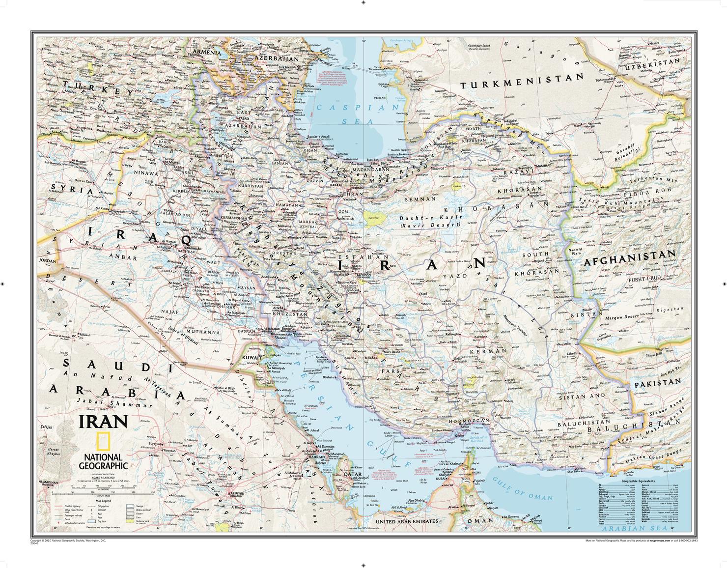
National Geographic's political map of Iran is one of the most authoritative and detailed maps available for this country that is heir to one of the world's oldest civilizations. This Classic style wall map features a bright color palette and stunning shaded relief that has been a hallmark of National Geographic maps for over 75 years. Thousands of place names, accurate political boundaries, national parks, mountain peaks and passes, swamps, deserts, lava fields, dry lakes and major infrastructure networks such as highways and roads, airports, railroads, oil fields and pipelines, and canals are detailed. Significant bodies of water, such as the Persian Gulf, Caspian Sea and Strait of Hormuz are shown with coastal bathymetry using depth curves and soundings. Coverage also includes Iraq, Qatar, Kuwait, Bahrain and parts of Syria. Saudi Arabia, UAE, Oman, Pakistan, Afghanistan, Uzbekistan, Turkmenistan, Azerbaijan and Armenia.
| Size | 30.25" x 23.5" |
|---|---|
| Publisher | National Geographic |
| Map Type | Wall Map |
| Printed By | MapShop |
| Published | 2023 |

