Hurricane Tracking Chart Wall Map by Kappa
$139.99 – $589.99
Size: 64" x 50"
Publisher: KAPPA
Published: 2013
Printed By: MapShop
Published: 2013
Printed By: MapShop
SKU: KA-HURRICANE-paper
Categories: All Products, Wall Maps, U.S. Region Maps
Quantity discounts on any combination of wall maps, raised relief or nautical charts!
Buy any 2, get $5 off || Buy any 5, get $20 off || Buy any 10, get $50 off
Buy any 2, get $5 off || Buy any 5, get $20 off || Buy any 10, get $50 off
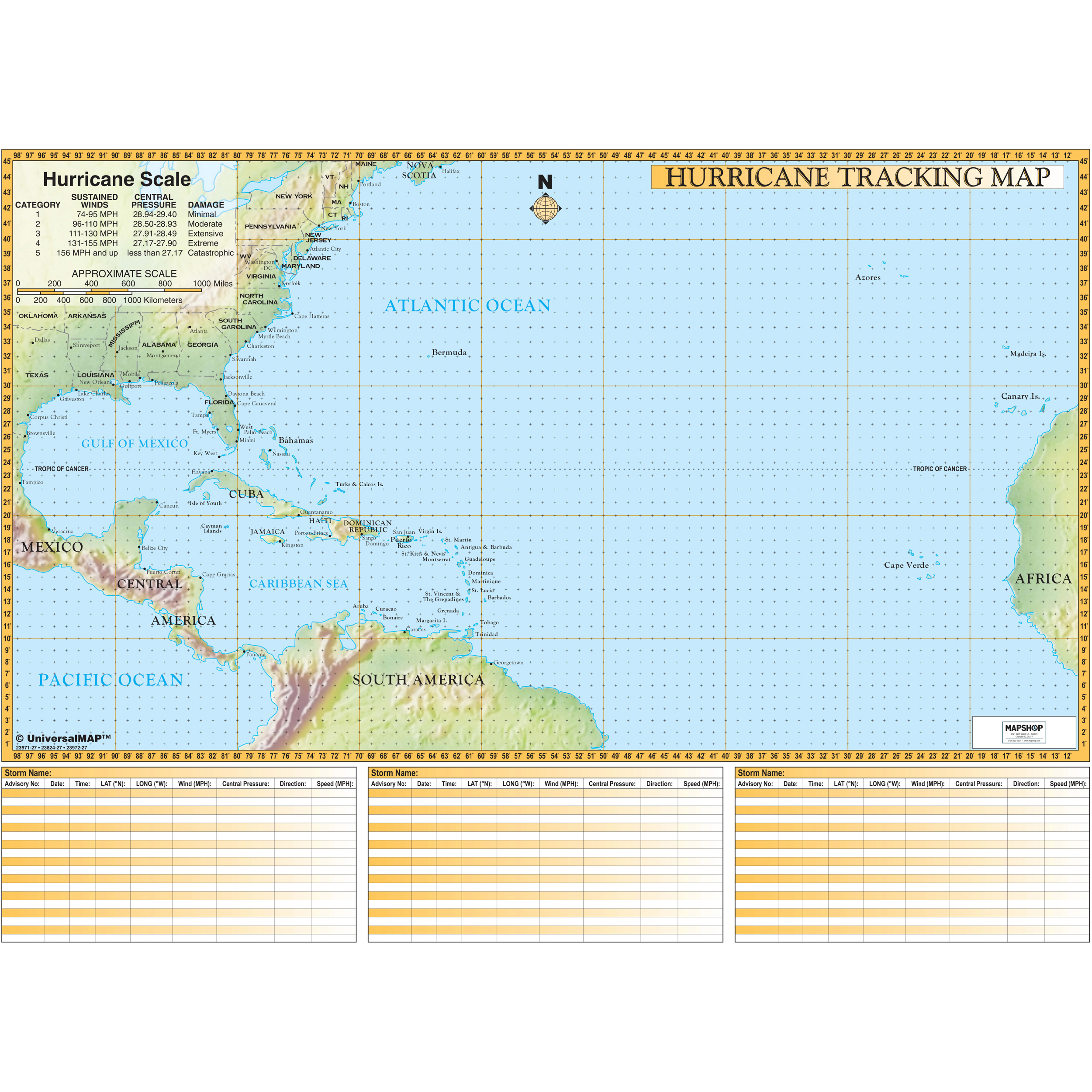
The Hurricane Tracking Chart Wall Map by Kappa Map Group is a fabulous tool for tracking storms! The map includes boundaries ranging north to the Maine-Nova Scotia Coast; south to the South American Northern Coastline; east to the African Coastline; and west to the Texas-Mexican coast and Central American coast. Features gridded longitude/latitude lines, a hurricane scale chart, and three storm tracking charts.
Size: 64″ x 50″
Published: 2013
| Print Finishing Options | Paper, Laminated, Laminated with Rails – Black Molding, Laminated with Rails – Walnut Molding, Spring Roller with Backboard |
|---|---|
| Publisher | KAPPA |
| Language | English |
| Published | 2013 |


