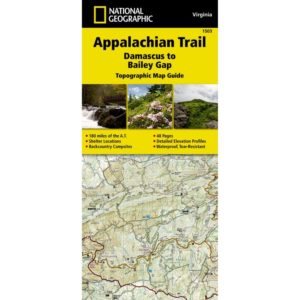
National Geographic – Appalachian Trail: Damascus to Bailey Gap [VA] – Trails Illustrated Folding Travel Map
$14.95 Original price was: $14.95.$7.98Current price is: $7.98.
Published: 2015
The Damascus to Bailey Gap Topographic Map Guide makes a perfect traveling companion when traversing the southwest Virginia section of the Appalachian Trail (A.T.).
Published: 2015 || Size: 4.25″ x 9.25″ (Folded)
In stock
Returns are not accepted on any clearance items. Sales for items on clearance are final.
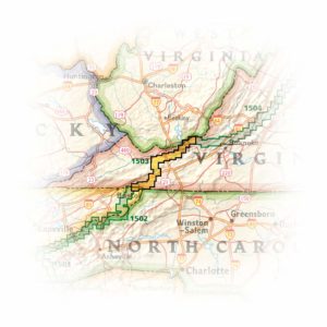
The Damascus to Bailey Gap Topographic Map Guide makes a perfect traveling companion when traversing the southwest Virginia section of the Appalachian Trail (A.T.). The A.T. in southwest Virginia travels through a culturally and historically rich area that includes fertile farmland, long, wooded ridges, and the highest mountains in the state. While the Mt. Rogers high country, just east of Damascus, is very popular with visitors, hikers can find excellent opportunities for solitude farther north on their way to the New River and Bailey Gap.
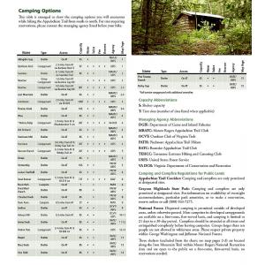
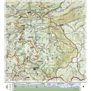
Each A.T. Topographic Map Guide includes detailed topographic maps at a detail of 1 inch = 1 mile. Each page is centered on the A.T. and overlaps with the adjacent pages so there is little chance of getting lost. Along the bottom of each page is a trail profile that shows the distance between shelters, camping areas, and trail access points. The map and trail profile provide a step-by-step visual guide to hiking the trail, mile by rugged mile. The Topographic Map Guide is built for all levels of hiking enthusiasts, from the day-tripper to the multi-month’ thru-hiker’. The front pages of the printed Topographic Map Guide include resupply information, town inset maps, camping options, and much more.
Map Size: 4.25″ x 9.25″ (Folded)
Published: 2015
Every Topographic Map Guide is printed on “Backcountry Tough” waterproof, tear-resistant paper. A full UTM grid is printed on the map to aid with GPS navigation. We love technology and enjoy the convenience of GPS, but you can’t plan a trip on a phone screen and navigation doesn’t work where there’s no cell signal. Start your next trip on the right foot with a high-quality folding travel map. Make the most of your next adventure, even if you lose GPS or cell signals. You’ll always be on the correct route with our folding travel maps. Your adventure starts here!
Coverage Includes
Abingdon Gap Shelter, Atkins, Bailey Gap Shelter, Bastian, Bland, Bluefield, Chatfield Shelter, Chestnut Knob Shelter, Damascus, Doc’s Knob Shelter, Grayson Highlands State Park, Helveys Mill Shelter, Hurricane Mtn Shelter, Jefferson National Forest, Jenkins Shelter, Jenny Knob Shelter, Knot Maul Branch Shelter, Lost Mtn Shelter, Marion, Mount Rogers, Old Orchard Shelter, Partnership Shelter, Pearisburg, Pine Swamp Branch Shelter, Princeton, Rice Field Shelter, Saunders Shelter, Tazewell, Thomas Knob Shelter, Trimpi Shelter, Wapiti Shelter, Wise Shelter.
What is a Topographic Guide?
The Topographic Map Guides are user-friendly and light-weight small book format maps printed on rugged waterproof, tear-resistant paper. They are laser focused to provide the tools needed for trail navigation. Each page includes a detailed topographic map and is centered on the trail. Along the bottom of the page is a trail profile that shows the distance between shelters, camping areas, and trail access points. The map and trail profile provide a step by step visual guide to hiking the trail, mile by rugged mile. The front pages of the printed Topographic Map Guide include resupply locations, key points of interest, safety guidelines, history, and everything you need to plan a safe and memorable hiking trip.
About the Author
Founded in 1915 as the Map Department of the National Geographic Society, National Geographic Maps is responsible for illustrating the world around us through the art and science of mapmaking. Today, National Geographic Maps continues this mission by creating the world’s best wall maps, outdoor recreation maps, travel maps, atlases and globes that inspire people to care about and explore their world.
Back-Orders & Out of Stock Items
If the item is currently out of stock it will ship as soon as we can get it. This will be shown in the “Normally Ships in” section above. If the item is on backorder you will recieve an email with updates as we recieve them. Our goal is to get your products to you a quickly as possible!
Returns are not accepted on any clearance items. Sales for items on clearance are final.
| Publisher | National Geographic |
|---|---|
| Language | English |
| Published | 2015 |
| Map Scale | 1 : 63,360 |

![National Geographic - Appalachian Trail: Damascus to Bailey Gap [VA] - Trails Illustrated Folding Travel Map](https://www.mapshop.com/wp-content/uploads/2017/10/9781597756402.jpg)
![National Geographic - Appalachian Trail: Damascus to Bailey Gap [VA] - Trails Illustrated Folding Travel Map - Image 2](https://www.mapshop.com/wp-content/uploads/2021/03/9781597756402-detail.jpg)
![National Geographic - Appalachian Trail: Damascus to Bailey Gap [VA] - Trails Illustrated Folding Travel Map - Image 3](https://www.mapshop.com/wp-content/uploads/2021/03/9781597756402-deatil2.jpg)
![National Geographic - Appalachian Trail: Damascus to Bailey Gap [VA] - Trails Illustrated Folding Travel Map - Image 4](https://www.mapshop.com/wp-content/uploads/2021/03/9781597756402-detail3.jpg)


